The Gallimaufry of Frostfell's
Cartography Vault

These maps was created using an image of the entire terrain map extracted from the client-side cell.dat file by AC Explorer.  Locations were assembled from researching official Asheron's Call resources, fan resources, and adventuring throughout Dereth.

[Back to the Gallimaufry]


Map of Dereth
Map of Dereth
1021x1100 PNG format 1263KB
Updated October 10, 2005
A large, detailed map of Dereth showing all land masses, including Osteth, the Direlands, Aerlinthe, the Vesayen Isles, Singularity Caul, Marae Lassel, Aphus Lassel, the Halaetan Islands, Vissidal Isle, and other currently unnamed and/or unreachable islands.  Superimposed over the map are the names and locations of all towns and many major points of interest.
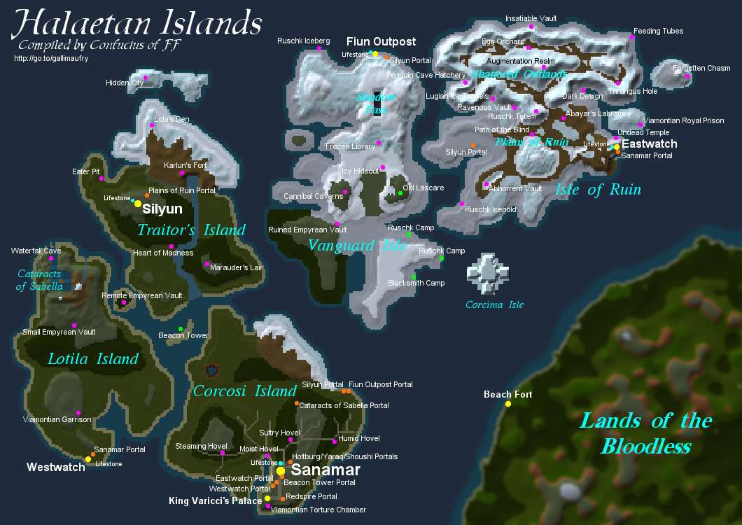
Halaetan Islands
Halaetan Islands
1060x750 PNG format 320KB
Updated October 10, 2005
The new Halaetan Islands archipelago introduced with the Throne of Destiny expansion, including all towns, dungeons, landmarks, and other various points of interest.

Marae Lassel
Marae Lassel
868x764 PNG format 159KB
Updated October 10, 2005
The island added in the Dark Majesty expansion, along with the locations of all towns, portals, dungeons, and other points of interest.
Aerlinthe
Aerlinthe
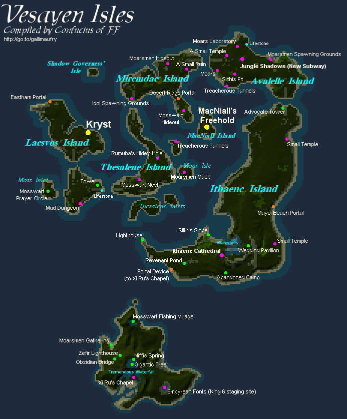
602x488 PNG format 48KB
Updated October 10, 2005
A map of the original hangout of Dereth's elite adventurers, with all dungeons and points of interest.
Vesayen Isles
Vesayen Isles
693x837 PNG format 89KB
Updated October 10, 2005
The Vesayen Island chain, with many dungeons, new creatures, two new towns, and the new southern island.

All maps are (C) 2000-2005 the Gallimaufry of Frostfell and may not be reused or reposted in any form without explicit prior consent.